By
Posted on
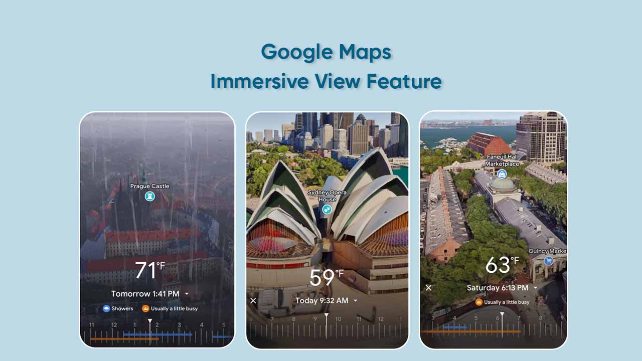
Google Maps has a significant Immersive View feature that enables users to explore locations in 3D. Eventually, it offers a bird’s eye view so that you can have a better look at your destination beforehand. One can pan, zoom, as well as tilt the view as per their requirements.
Apart from visual tweaks, Immersive View integrates some useful facilities such as weather conditions, traffic, and occupancy data. Thus, you can get more accurate details of a location at a particular time.
How to use the Immersive View feature in Google Maps?
- Install the latest version of Google Maps
- Open the Google Maps app
- Search for a landmark in one of the supported cities (Big Ben for London)
- Click on the Immersive View card
- Tap on Time & Weather to see the accurate lighting
Follow our socials → Twitter/X, Telegram, WhatsApp, Facebook